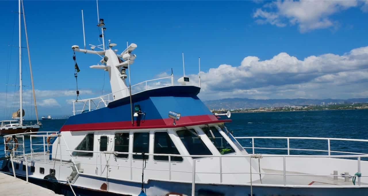
Hydrographical surveys are a domain of CMU TAGU. The installed sensors comprise a multi beam echo sounder and a single beam echo sounder. Positioning is done with the latest Trimble GPS receivers, which also enable a solution as GPS gyro. For compensation of vessel movement a motion sensor is integrated.
With the modern hardware installed and use of the software from QPS (QINSy and Qloud) quick and high-class data acquisition and processing is facilitated. Additional sensors as side scan sonar, sub- bottom profiler, magnetometer etc. can be integrated at any time. Sensors and devices can be easily deployed from the quarterdeck. The survey cabinet does provide sufficient space for additional components and operators, if required.
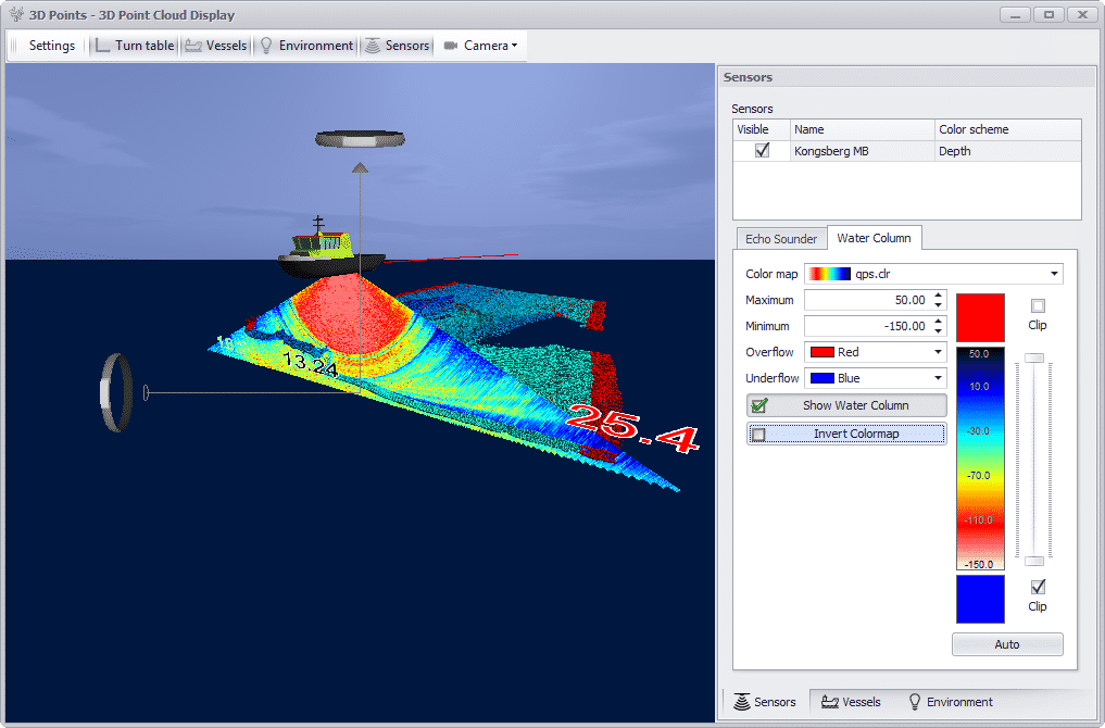
See the Multi Beam Echo Sounder in action
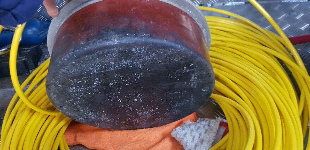
KONGSBERG Multi Beam Echo Sounder EM3002
Kongsberg EM3002 multi beam echo sounder (MBES) with extremely high resolution and dynamically focused beams. Well suited for detailed seafloor mapping and inspection applications.
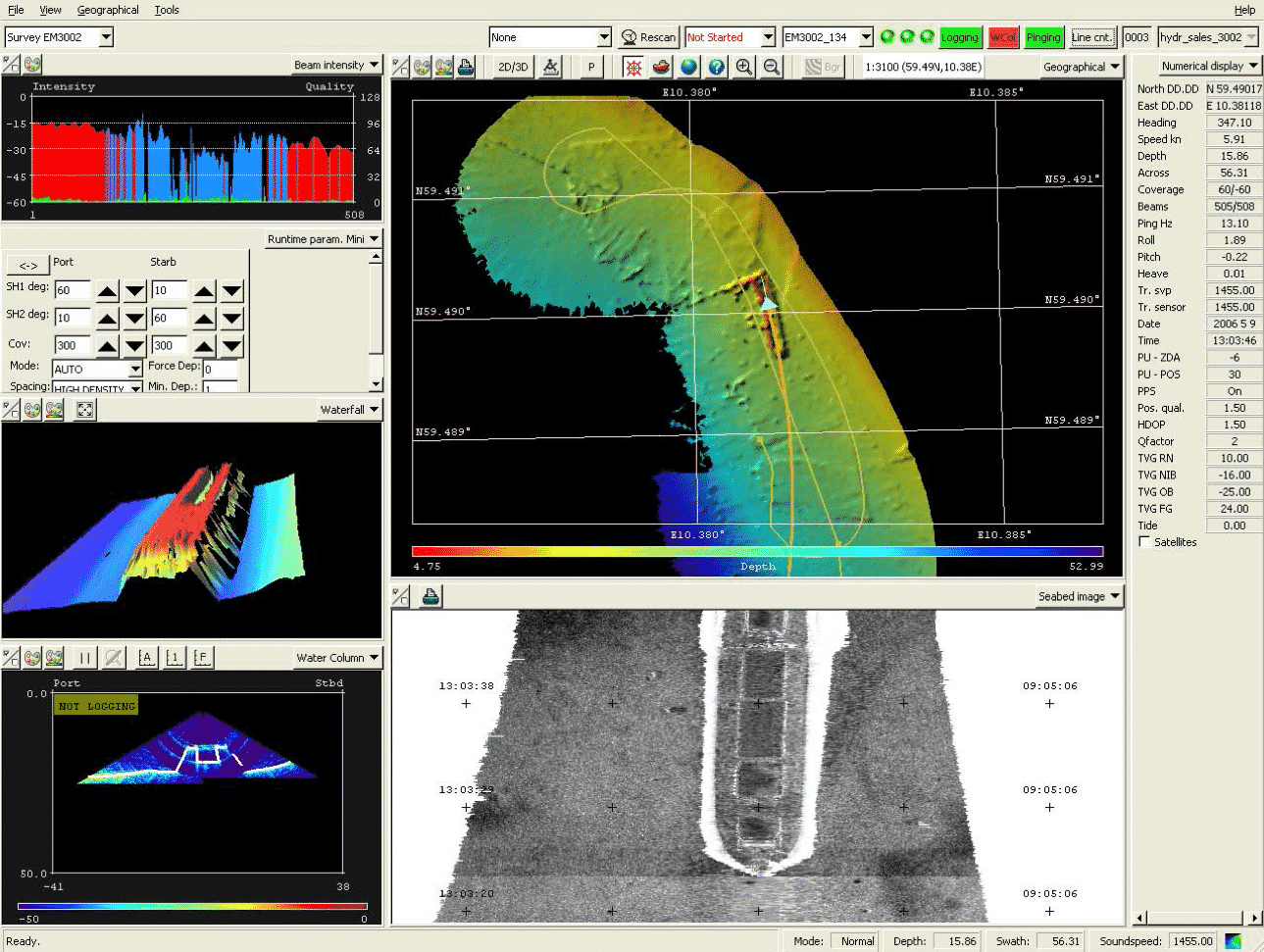
The Kongsberg EM 3002S is mapping the relative water depth along a stripe perpendicular to the vessel axis. The system consists amongst others of a transducer (transmitter) and an independent receiver. The transducer emits an acoustic pulse (“ping”), which spreads through the water. The amount of time it takes for the sound waves to bounce off the seabed and return to the receiver is used to determine water depth.
The Kongsberg EM3002S conforms to the latest standard of the International Hydrographic Organisation (IHO).
The MBES is connected to the MBES recording software QPD QINSY, which not only records data but also performs online quality control of acquired data.
When all available echo sound beams are enabled the Kongsberg EM 3002S achieves a maximum sector coverage of 130 degrees. Though the outer beams tend to deliver not as high-class data acquisition results as the inner beams all measurements are recorded. Measurements which lack a certain quality level can be chosen to be automatically excluded from further processing. For this selection process a variety of parameters can be applied, with mainly signal strength and signal- to-noise ratio used as criteria during recording.
KONGSBERG -SIDE SCAN ECHO SOUNDER - EA 400
FOR ACCURATE SURVEYING
In addition to regular depth sounding the KONGSBERG EA400 Hydrographic Echo Sounder can now be employed for side looking sonar surveying. One or two 120kHz or 200kHz side looking transducers, mounted on a pole or on the side of the keel, may be utilized for excellent and accurate surveying of harbours or other relatively shallow areas.
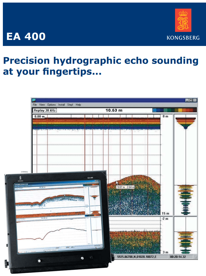
The Kongsberg EA 400 is a single beam echo sounder, sending out a single beam at a frequency of 200 kHz or 15 kHz respectively. The signal is reflected from the seabed and transmission time recorded and processed analogous to the MBES described above. The frequency of 200 kHz is used for seabed mapping whereas the frequency of 15 kHz has the capability of penetrating the seabed deeper allowing to draw conclusions from the seabed’s sediment composition.
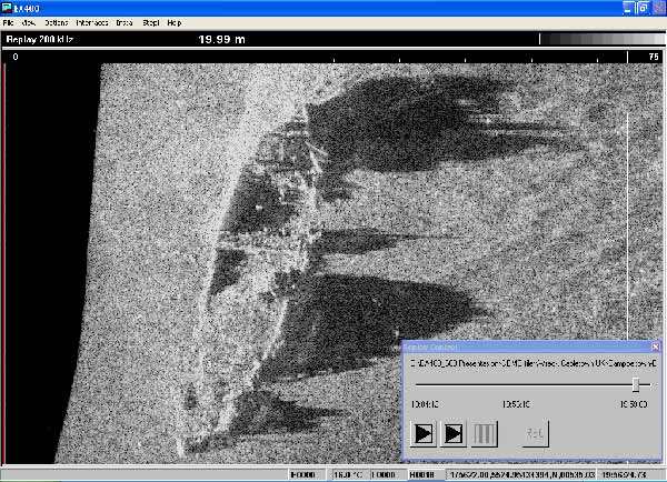
Single side scan with 200 kHz – wreck detection
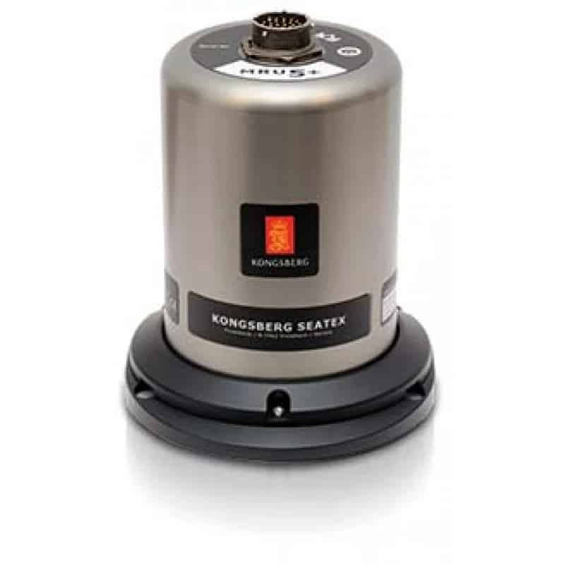
KONGSBERG Motion Sensor
The measurements of the multi beam echo sounder have to be corrected with information from a motion sensor to eliminate faults from the vessel movements roll, pitch and heave.
On board CMU TAGU is a KONGSBERG Seatex MRU5 motion sensor installed. This unit provides high accuracy roll, pitch and heave measurements and accelerations. The dynamic accuracy of roll and pitch amounts to 0.03° RMS at a ±5° amplitude. The heave motion output has an accuracy of 5 cm or 5 , whichever is highest.
Trimble SPS 851 Gyro/GPS
To determine the position and the heading Trimble GPS receivers (SPS851 and SPS551H respectively) are deployed.
The Trimble SPS 851 provides accuracies of 10 mm + 1 ppm (horizontal) and 20 mm + 1 ppm (vertical) with support of correction data (Beacon, VRS Now, SAPOS, ASCOS) up to
Correction data are received via a beacon antenna or via internet-based stream.
The heading is calculated from the position measurements provided by SPS 851 and SPS 551H in the latter device. The rated accuracy is 0.05°.
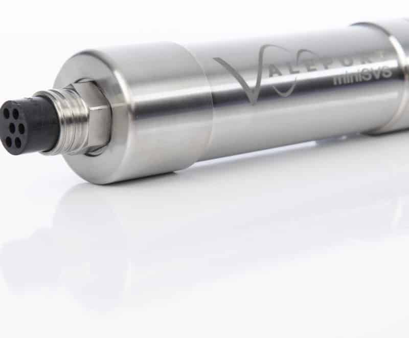
Valeport Sound Veloctity
The sound velocity is required for calculation of water depth. The velocity data are measured, recorded and transferred to the MBES system. The measurement of sound velocity is performed by a Valeport mini SVS sensor with pressure sensor in fixed periods. The sensor is lowered through the water column and a sound velocity profile is continuously recorded.
In addition a sound sensor continuously measures the sound velocity at the same level as the multi beam sensor. This is performed to improve beam forming. The accuracy of depth calculation is very much dependent on the accuracy of the sound velocity. For this reason the sound velocity sensors are calibrated by the manufacturer on a regular basis. Calibration protocols for each sensor are available.
Real time navigation and data acquisition software
On board CMU TAGU is deployed the real time navigation and data acquisition software Qinsy from QPS (Netherlands) for recording of the MBES, SBES and positioning data.
QINSy can simultaneously collect and process data from a variety of sensors. Navigation, gyro, motion sensor and echosounders including MBES are used as standard sensors.
Qinsy is capable of online quality control of the acquired data in parallel to the ongoing data acquisition. Different quality criteria such as overlap, sampling rate per area or standard deviation can be checked. In addition a preliminary mapping of the seabed can be done.